Wissahickon’s 80th Anniversary is fast approaching. We will celebrate by holding a picnic at Mingo Park, Shelter 4 on Saturday, June 18th. More details to follow!
September, 2021 Meeting
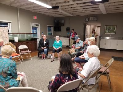
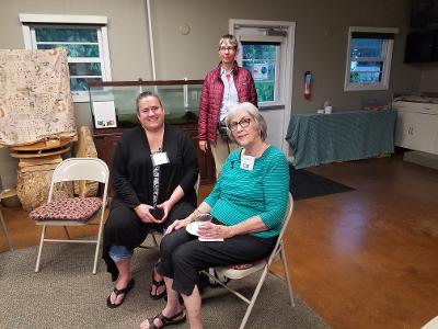
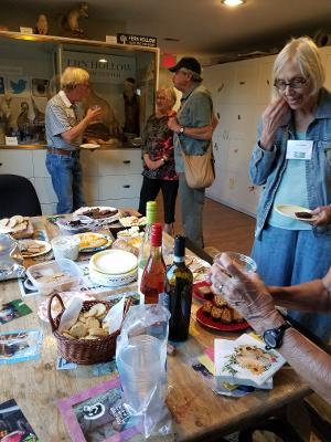
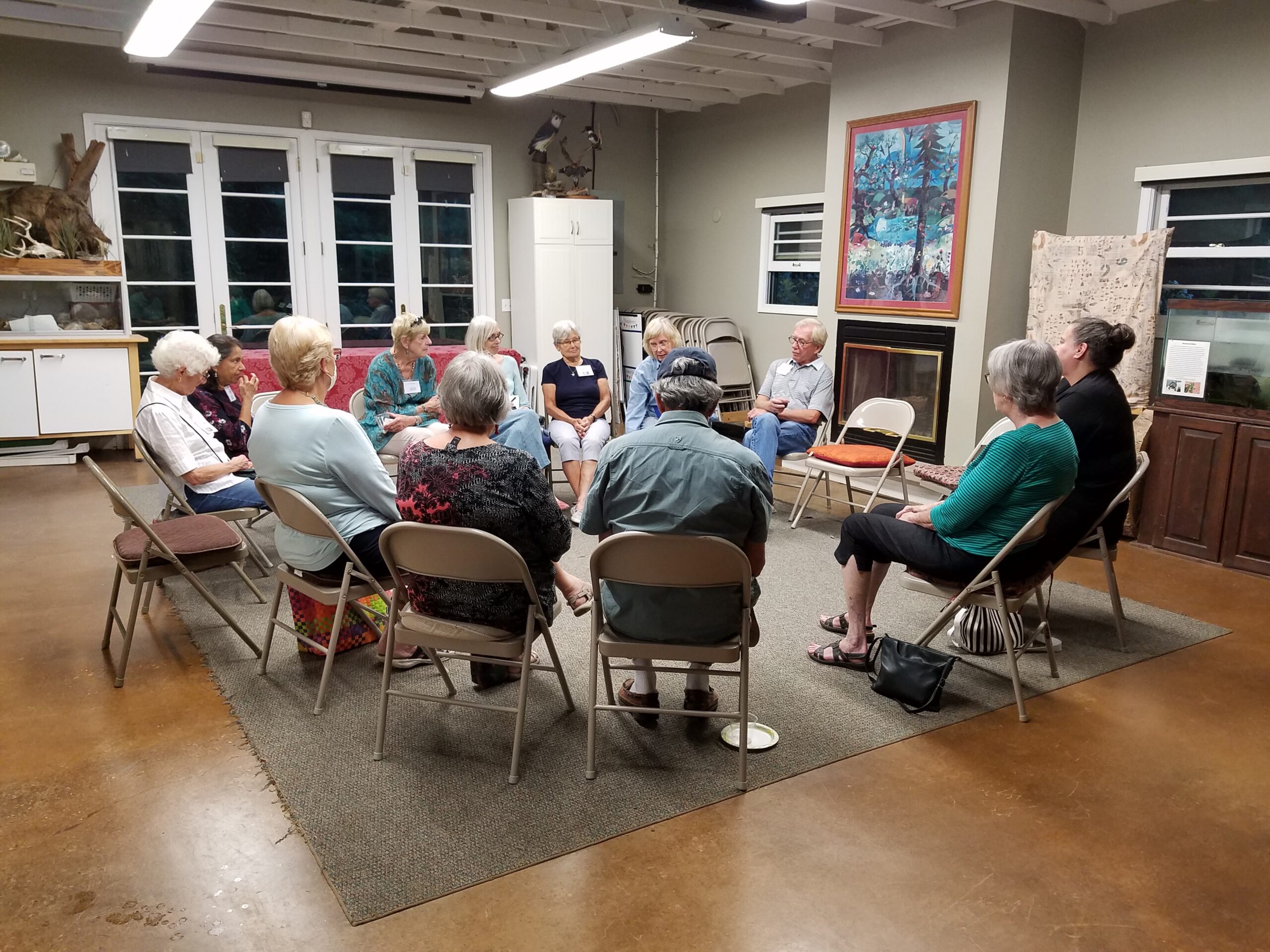
14 members attended our wine/cheese social to kick off the new club year. Since attendance at our meetings has been steadily declining because of Covid and an aging membership, it was decided to stop holding meetings and concentrate on field trips, an annual picnic and keeping our website updated. It was voted to send a $300 contribution to Fern Hollow Nature Center for their support over the years. Dues will NOT be collected until further notice.
You Are Invited
When: September 9, 2021 7:00 PM
What: Wissahickon Annual Wine and Cheese Meeting
Where: Fern Hollow Nature Center
1901 Glen Hollow Road, Sewickley, PA 15143
The club will provide the wine and paper products.
Attendees please bring cheese or another snack to share.
Agenda: Since this is our first in-person meeting in over a year, we will devote the time to socializing with a short business meeting to discuss the future of the club.

Jennings Trip Report
We couldn’t have asked for better weather. 80 degrees and no humidity.
Over 45 people agreed it was a perfect hiking day. Read our list here:
Jennings Field Trip July 23, 2021
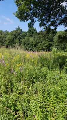
Friday, July 23,2021 10:00 AM Jennings Prairie, Leaders: Dianne and Bob Machesney
(C) 412-523-0368
Visit the unique ecosystem at Jennings Prairie.
This is the perfect time to explore the relict prairie. The hot weather brings the stunning Blazing Star and some of the other dazzling summer flowers to peak performance. The goldenrods of fall will begin to show. Don’t miss the spectacular butterflies that grace the prairie with their breathtaking beauty. Flycatchers, vireos, tanagers, Common Yellowthroats and Cedar Waxwings sometimes make an appearance. We may come across a Red Eft, the larval form of a Red-spotted Newt.
Outings are free and open to the public. Bring your friends. Trails are wheelchair accessible.Wear a hat and sunscreen. Bring binoculars, field guides, water and a lunch.
Directions From Pittsburgh: take I-79 North to Exit 99, New Castle/ Butler. Drive east on Route 422 roughly 5.8 miles to the Prospect Exit. Turn left (north) onto Route 528.
Continue on Route 528 for about 7 miles. Meet in the Jennings Environmental Center Parking Lot on the left (west) side of the road.
June, 2021 Field Trips
Saturday, June 5, 2021, 9:00 AM
Work Day at Fringed Gentian Fen and Plain Grove Fen Natural Areas, Lawrence County
Western Pennsylvania Conservancy is having a Volunteer Land Steward Work Day at Fringed Gentian Fen Natural Area and Plain Grove Fen Natural Area. Let’s show our appreciation for the conservation of these areas by joining them for invasive plant removal, woody vegetation control and tree-planting maintenance.
For additional information, go to: https://waterlandlife.org/volunteer/ , Select “Current Volunteer Opportunities, and the Sat., June 5 event. For questions, contact Andrew Zadnick, Director of Land Stewardship at azadnik@paconserve.org or (412) 977-9681 (cell).
We will meet at 9:00 AM along Frew Mill Road in Shenango Township.
Directions: From Pittsburgh, take I-79 North to Exit 99‑US 422. Turn left onto US 422 west and travel 7 miles. Turn right at PA 388 North and continue 1.2 miles to Frew Mill Road. Turn left onto Frew Mill Road and continue 0.7 mile.
GPS Coordinates: 40.9904, -80.28111
Sunday, June 13, 10:00 AM
South Sandy Creek in State Game Land 39, Venango County
Leader: Ron Zagrocki; Cell:( 717) 580-5736
Directions: From Pittsburgh, take I-79 north to Exit 121 for US 62 Mercer/Franklin. Turn right and continue 2 miles the point where US 62 turns to the left – but continue straight onto PA 965. Travel PA 965 for 8.5 miles to turn right onto Slatertown Road, a dirt road. Continue 2 1/4 miles to a gravel parking lot on the left. If you drive over an open-grate bridge, you’ve gone too far.
GPS coordinates: 41.29860, -79.94920
Saturday, June 19, 2021, 1:00 PM
Ferncliff Peninsula, Ohiopyle State Park, Fayette County
Leader: Mark Bowers
Contact Information: 4beagles@verizon.net;
cell: (724) 454-4012
Directions: From Pittsburgh, take the PA Turnpike to Exit 91 – Donegal. Turn east (left) on PA 31. Travel about 2 miles and turn south (right) on PA 381. Travel ten miles to Normalville to a stop sign. Turn left onto PA 381 south and continue 11 miles to Ohiopyle. As PA 381 enters Ohiopyle, it crosses railroad tracks. Turn right just before the bridge over the Yough to enter the Ferncliff parking lot, where we will meet.
Although the state park will be crowded with enthusiastic outdoor recreationists and sightseers, the inland trails will be quiet and ideal for a wildflower hike. We may first head to another hiking trail, so if you arrive late, please call Mark at 724-454-4012 or look for a note directing you to the correct trail.
GPS coordinates: 39.87150, -79.49320
May Field Trips 2021
Saturday, May 15, 2021, 1:00 PM
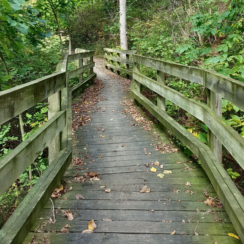
Boyce Mayview Regional Park, Upper St. Clair Township, Allegheny County
Leader: Mary Ann Pike
Contact Information: cell: (412) 855-8239; mapike@earthlink.net
We will initially travel downhill to get to the riparian forest and wetlands at the bottom.
Directions: From Pittsburgh, proceed south on US 19 (Washington Road) to Boyce Road which is 3.0 miles south of South Hills Village (at Fort Couch Road). Turn right onto Boyce Road and proceed 0.5 mile to the intersection with Morton Road on the right. Turn right onto Morton Road and continue about 1.5 miles to parking for the Morton Complex on the left side of the road. Park here.
Alternatively, take I-79 south.Take Exit 54/ Bridgeville. At the end of the ramp, turn right onto Millers Run Road (PA 50) and proceed to the traffic light at the T-intersection with Washington Pike. Turn right onto Washington Pike and drive for 2.1 miles to the intersection with Boyce Road. Turn left onto Boyce and proceed 1.4 miles to the traffic light at the intersection with Mayview Road. Continue on Boyce Road for another 1.1 mile to Morton Road. Turn left onto Morton Road and continue about 1.5 miles to parking for the Morton Complex on the left side of the road. Park here.
GPS Coordinates: 40.32842, -80.09581
Saturday, May 22, 2021, 12:30 PM
Cornplanter State Forest, Strawbridge Tract Crawford County
Leaders: Joe and Bonnie Isaac; Cell- 724-944-7160; E‑mail: IsaacB@CarnegieMNH.Org
Start time: 1 p.m. but bring your lunch to enjoy the picnic area at 12:30 pm-ish.
Directions: From Pittsburgh, take I-79 north to Exit 147A for Meadville. Turn right onto US 19. On the highway bridge into town, stay in the right lane to continue straight into town onto Park Ave. Continue 3/4 mile and turn right onto North St for PA 27 East. Continue about ½ mile to pick up a left hand turn onto PA77 East. Continue 12 miles to turn right onto PA 408. Travel PA 408 for 7 miles to Strawbridge Road. Turn left and continue about ½ mile to the parking and picnic area.
GPS coordinates: 41.6754, -79.8533 Reply Reply All Forward
Earth Day Field Trip
Come join the Westmoreland Land Trust for an Earth Day celebration of wildflowers along the rich wooded slopes of Otto and Magdalene Ackermann Nature Preserve. The first part of the walk is an easy stroll along Old Dirt Road Trail. Those who wish to continue on a moderate walk can join us down the Wedding Trail for waterfalls and trilliums. Along the floodplain of Blue Dell Run, see more flowers, and learn about recent tree and shrub plantings, and new interpretive signs.
We will practice social distancing. See https://www.cdc.gov/coronavirus/2019-ncov/daily-life-coping/visitors.html for ways to enjoy the outdoors. Stay home if you do not feel well. Stay at least 6 feet away from people you don’t live with. Wear a mask.
Everyone of all ages is welcome, and no need to register. Attend with walking shoes that can get muddy. If you have any questions, please contact Loree Speedy at loreespeedy@gmail.com or 724-518-6022.
Directions: To reach the reserve from points east (Greensburg/ Irwin turnpike interchange) – From Turnpike, travel US 30 WEST (toward Pgh). Travel US 30 for 4.8 miles to turn right onto Leger Road. There is a Sheetz on the left corner (but get in right lane).Turn right onto Leger Road and travel (bearing left at any Y’s) through the countryside for 2 miles. (Ignore the closed road signs as they are referring to the bridge over Brush Creek).
At the base of a hill, continue straight onto Ardara Road when Leger Road turns right. At the top of a hill, look for the green Ackermann Nature Preserve sign on the left and park at the end of the grassy strip between two homes. It may look like you are turning into a lawn, but you will see the kiosk at the end of grassy strip.
GPS coordinates: 40.36105, -79.74410 – The GPS directions may direct you to turn right off of US 30 before Sheetz.
—
Betsy Aiken
Executive Director
Westmoreland Land Trust
westmorelandlandtrust@gmail.com
724 325-3031
Watch Doug Tallamy Lecture
On February 21, 2021 the Botanical Society of W. PA hosted Doug Tallamy, author and conservationist, in a Zoom Lecture w/ Allegheny County Chapter of Izaak Walton League of America. They are graciously sharing the link to the recording.
https://www.youtube.com/watch?v=8u4eKHjx7Fs
Spring Field Trips 2021
Everyone is welcome, including non-members. Trips last 3 to 4 hours but one can leave at any time. For questions, call the field trip leader or Loree Speedy at (724) 518-6022 (cell) or loreespeedy@gmail.com.
Sunday, March 28, 2021, 1:00 PM
Little Sewickley Creek at Herminie, Westmoreland County
Coordinator: Loree Speedy; loreespeedy@gmail.com; (724) 518-6022 cell
This is a favorite trip for Snow Trillium. The walk is easy along an old railroad grade.
Directions: Take the PA Turnpike to Exit 67-Route 30/Irwin/Greensburg. Take the Route 30 East/Greensburg ramp. At the first stoplight on Route 30, turn right onto Arona Road, then another right after 0.5 mile onto unmarked Wendel Road. Travel this road 3.7 miles to a T. Turn right at the T and continue 1 mile to Herminie to a 4-way stop (VFD on corner). Continue straight to the next stop sign and turn left. Proceed through 2 more stop signs, end at a T, and turn right. Continue past the Dairy Queen on your right and continue down a hill; we will meet just before the highway bridge. Park on the left side.
These directions are difficult as roads are unmarked and state roads through Herminie sometimes look like alleys. If you can use them, the GPS coordinates will likely take you by a more direct route. GPS coordinates: 40.26050, -79.72700.
Saturday, April 3, 2021, 1:00 PM
Cedar Creek Park, Westmoreland County
Leader: Mark Bowers; Cell- 724-454-4012; E-mail: monada55@gmail.com
Directions: From Pittsburgh, travel PA 51 south to its junction with PA 201 (just after Bills and Willowbrook Plaza). Continuing on PA 51, travel 2 additional miles to the traffic light for Concord Ln and turn left. (This traffic light at Concord Ln can also be reached by I-70 exit 46B and continuing north on PA 51 to the northern Concord Ln intersection across from C Harper car dealership.) Traveling on Concord Ln, turn left onto Municipal Dr. Continue about 0.6 mile, pass Timm’s Ln, and turn left into the main entrance to Cedar Creek Park. Follow this road downhill, cross the bike trail, and turn left to continue through a series of parking lots until you reach the farthest parking lot, near the Gorge Trail.
GPS coordinates: 40.17830, -79.77820. (The road configuration near Concord Ln has just been modified, and GPS units and Google Maps have not yet been updated).
Sunday, April 11, 2021, 1:00 PM
Crouse Run Nature Reserve, Allegheny County
Coordinator: Loree Speedy; loreespeedy@gmail.com; (724) 518-6022 cell
Directions: We will meet at the restaurant parking lot along Wildwood Road between PA Route 8 and North Park. At intersection of Wildwood Road and PA 8, head west for ½ mile to a restaurant parking lot on the left. If you are coming from North Park, the restaurant parking is on the right, 1.1 miles from the Wildwood Sports Complex.
GPS coordinates: 40.59020, -79.95710

