Trip Report Jennings
Reply
 Remember, our club year starts in September and runs to the end of August. Dues for the 2014/2015 year are being accepted now. Please bring your check to a meeting or mail to our Treasurer at 105 Lindley Lane, Pittsburgh, PA 15237. Checks should be made payable to: Wissahickon Nature Club. $7 for an individual or $10 for a family.
 .
.
Our kick-off meeting on September 4th will be a wine and cheese reception . The club will provide the wine. Members will kindly bring hors d’oeuvres or cheese rather than desserts. Please leave a reply below to RSVP so we know how much wine to purchase.
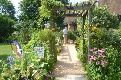
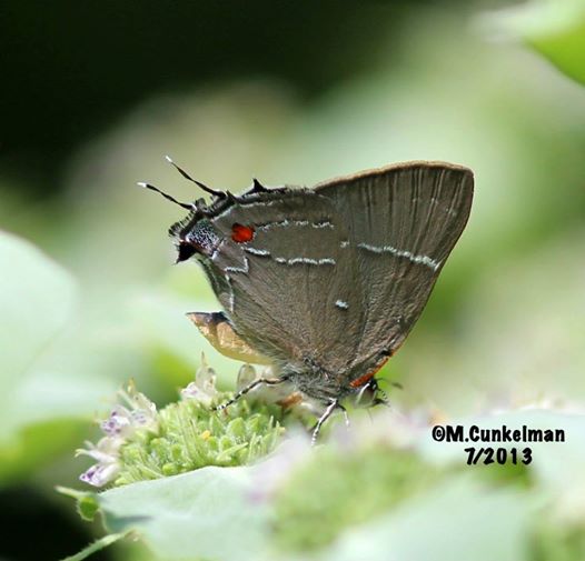
Thanks to the Cunkelman’s for a lovely day exploring their 4 acres in Clarksburg, PA
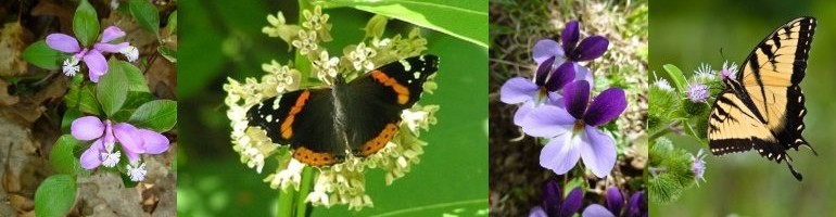
Join us on our annual outing to Jennings Prairie in Butler County, PA on Saturday, July 26th.
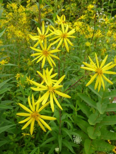
This is the perfect time to see Blazing Star, Whorled Rosinweed and sunflowers. American Goldfinches, Indigo Buntings, flycatchers, Common Yellowthroats and Cedar Waxwings make the prairie their summer home. Expect to see an amazing array of glorious butterflies. We may come across a Red Eft or catch a glimpse of the elusive Eastern Massasauga Rattlesnake.
Meet leaders Dianne and Bob Machesney at 10:00am at the Jennings Environmental Education Center (across from Prairie parking lot) on the right (east) side of the road.
Google Maps: 2951 Prospect Rd. Slippery Rock, PA 16057, (724) 794-6011
Directions from Pittsburgh: Take I-79 North to Exit 99/Butler. Drive east on US 422 roughly 5.8 miles to the Prospect Exit, and turn left (north) onto PA 528. Continue on PA 528 for about 7 miles.
The Prairie is hot and shadeless. Wear a hat, sunscreen and appropriate hiking shoes. Bring binoculars and field guides. Bring a lunch and beverage, water and a snack for the trail. We will picnic together after the hike.
Outings are free and open to the public.
For more information, call Judy Stark, Outings Coordinator (412)363-0462
10:30 AM Saturday, July 12, 2014
Marcy is graciously inviting club members to her yard to check out the flora and fauna. She lives in Clarksburg, PA. Bring a bag lunch and we will socialize after the tour. If you think you are able to attend, contact Judy Stark, Outings Coordinator, at starkj2@aol.com and she will email exact directions to you.
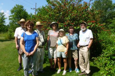
We had a excellent tour of Preston Park last Saturday. There were about 10 of us plus two guides Dave Heltzell and Tony Stagno. We saw very few ‘wild flowers’, but the Rhododendron, Azalea and Lilacs were lovely. The big surprise was the meadow full of shooting stars we found at the end. Click here to view photos. Submitted by Judy Stark.
Monday June 9, 2014 10:00 AM
Leader: Dianne & Bob Machesney (c) 412-523-0368 diannem15237@aol.com
Greenock Portion of the Great Allegheny Passage (GAP) Trail, Allegheny County
Directions: From Pittsburgh, take I-376 (Parkway East) to Exit 78A – Forest Hills/ US 30. Travel US 30 west about 7 miles to PA 48. Turn right (south) on PA 48 and travel 6 miles to the Boston Bridge. Cross the bridge over the Youghiogheny River, turn left onto E. Smithfield Street. Go approximately 2.1 miles, and turn right onto Moray Lane. Immediately past the “Ray’s Way Bar” turn left into the driveway. Go to the back and park in the lot for the baseball field.
The closest GPS address is: 525 Moray Dr., Greenock, PA 15047.
There is a picnic shelter with tables. We will start our walk at the 21.5 mile marker of the trail. We will walk abut 2 miles toward the 24 mile marker, turn around and return to a picnic shelter. Bring a bag lunch and water.