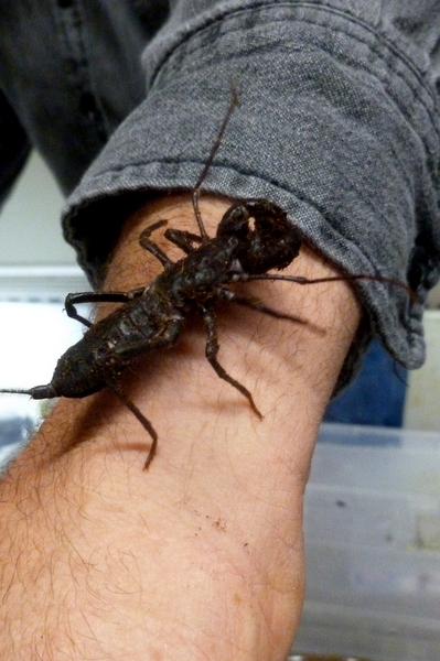
Steve Leitkam ended his powerpoint presentation with some “hands on” time.
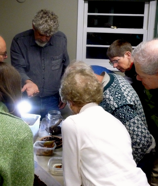
Nineteen members had the opportunity to hold Steve’s pet Whip Scorpion. Thanks, Steve, for a great meeting.


Steve Leitkam ended his powerpoint presentation with some “hands on” time.
Nineteen members had the opportunity to hold Steve’s pet Whip Scorpion. Thanks, Steve, for a great meeting.
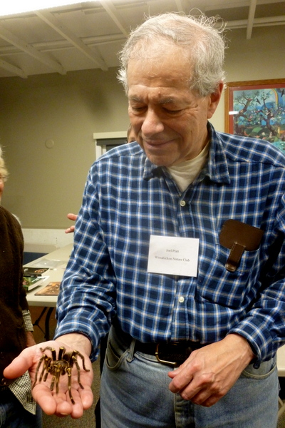
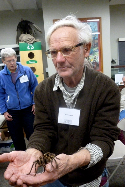
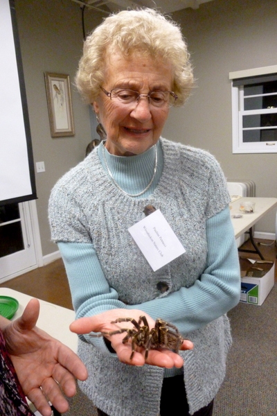
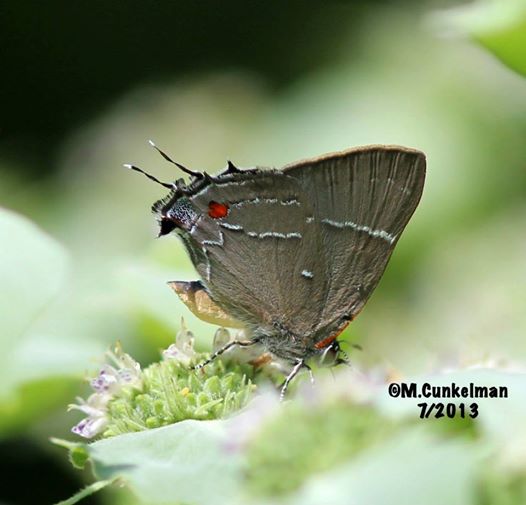
Are you brave enough to hold a tarantula? Our members are fearless! Thanks to Sarah Lyle, who shared her knowledge of arachnids and brought some of her pets for us to meet at the October meeting.

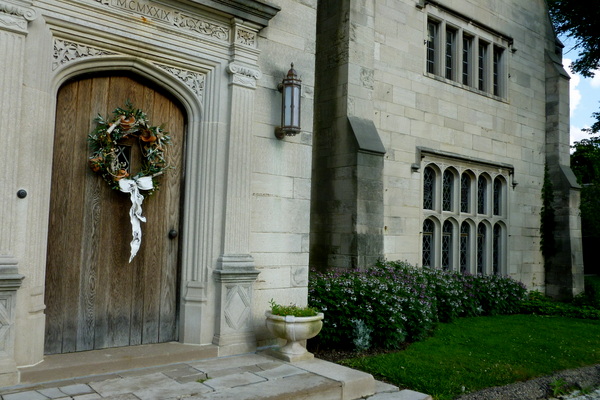
Hartwood Acres Mansion
Fall Outing to Hartwood Acres, Allegheny County
Outings are not exclusive to members. Everybody’s invited to walk with us.
Dress for the weather. Wear boots or good hiking shoes and a hat. Bring
binoculars and field guides.
October 24, Friday, 10:00 a.m. – Noon. Hartwood Acres Park, by Marlow Madeoy
412-364-0195 madeoyma@aol.com and Judy Stark 412-327-9537 starkj2@aol.com
Come out for a lovely fall walk to enjoy the colors of late wildflowers and
learn how to identify trees.
Directions: From Route 28, take Route 8 N for 1.8 miles, turn Right on
Saxonburg Boulevard, go 4.6 miles (crossing Harts Run Rd), turn left into
Hartwood Acres Park and drive up the hill to the parking lot for the Mansion.
Or set your GPS for: Hartwood Acres Park, 200 Hartwood Acres, Pittsburgh, PA
15238
Bring a picnic lunch if the weather is warm, otherwise there are several
restaurants on Harts Run Road.
Join us on our annual outing to Jennings Prairie in Butler County, PA on Saturday, July 26th.
This is the perfect time to see Blazing Star, Whorled Rosinweed and sunflowers. American Goldfinches, Indigo Buntings, flycatchers, Common Yellowthroats and Cedar Waxwings make the prairie their summer home. Expect to see an amazing array of glorious butterflies. We may come across a Red Eft or catch a glimpse of the elusive Eastern Massasauga Rattlesnake.
Meet leaders Dianne and Bob Machesney at 10:00am at the Jennings Environmental Education Center (across from Prairie parking lot) on the right (east) side of the road.
Google Maps: 2951 Prospect Rd. Slippery Rock, PA 16057, (724) 794-6011
Directions from Pittsburgh: Take I-79 North to Exit 99/Butler. Drive east on US 422 roughly 5.8 miles to the Prospect Exit, and turn left (north) onto PA 528. Continue on PA 528 for about 7 miles.
The Prairie is hot and shadeless. Wear a hat, sunscreen and appropriate hiking shoes. Bring binoculars and field guides. Bring a lunch and beverage, water and a snack for the trail. We will picnic together after the hike.
Outings are free and open to the public.
For more information, call Judy Stark, Outings Coordinator (412)363-0462
10:30 AM Saturday, July 12, 2014
Marcy is graciously inviting club members to her yard to check out the flora and fauna. She lives in Clarksburg, PA. Bring a bag lunch and we will socialize after the tour. If you think you are able to attend, contact Judy Stark, Outings Coordinator, at starkj2@aol.com and she will email exact directions to you.

Monday June 9, 2014 10:00 AM
Leader: Dianne & Bob Machesney (c) 412-523-0368 diannem15237@aol.com
Greenock Portion of the Great Allegheny Passage (GAP) Trail, Allegheny County
Directions: From Pittsburgh, take I-376 (Parkway East) to Exit 78A – Forest Hills/ US 30. Travel US 30 west about 7 miles to PA 48. Turn right (south) on PA 48 and travel 6 miles to the Boston Bridge. Cross the bridge over the Youghiogheny River, turn left onto E. Smithfield Street. Go approximately 2.1 miles, and turn right onto Moray Lane. Immediately past the “Ray’s Way Bar” turn left into the driveway. Go to the back and park in the lot for the baseball field.
The closest GPS address is: 525 Moray Dr., Greenock, PA 15047.
There is a picnic shelter with tables. We will start our walk at the 21.5 mile marker of the trail. We will walk abut 2 miles toward the 24 mile marker, turn around and return to a picnic shelter. Bring a bag lunch and water.
Saturday, May 24, 2014 10:00 AM
Preston Park, Butler Township, Butler County
Leader: Judy Stark and Tony Stango
Preston Park is an 88-acre English garden donated to Butler Township by Dr. Frank Preston, founder of Preston Laboratories, and Mrs. Jane Preston. Dr. Preston, a glass scientist, ornithologist, and ecologist, created and designed an English garden as a place to live, work and enjoy nature. Dr. Preston apparently walked the entire property daily at dawn, in accordance with his origins in England where a deep interest in nature is a great pastime.
Park Volunteer Tony Stango will introduce us to the park’s significant historical and cultural resources, including Dr. Preston’s glass research laboratory. Preston Park is listed on the National Register of Historic Places and is now maintained by Butler Township. For more information, visit Butler Township’s Preston Park website
Directions: Travel I-79 north to Exit 83 – PA 528 toward Evans City. Travel PA 528 north for 2.6 miles to a T. Turn right at the T and continue east on PA 68 for 9 miles to Whitestown Rd (the first traffic light after the Butler Farm Show on the right).Turn right onto Whitestown Rd and continue 1 mile to turn right onto South Eberhart Road. Park entrance will be on the left. The GPS address is 415 South Eberhart Road, Butler, PA 16
Outings are free and open to the public.
May 30, 2014 Friday 10:00 AM
Butler/Freeport Trail, Sarver, PA Leader: Chuck Tague
Directions: From Pittsburgh, take Rt. 28 North to Exit 17 (PA356/Butler/Freeport). At the end of the ramp, head west or north on PA 356. After roughly 3.5 miles, turn right onto Sarver Road (SR2018) at a traffic light. Continue a little over 1/2 mile, traveling down a hill. After crossing a creek and passing the Sarver buffalo Township fire Hall on the left, turn left into the bike trail parking area, where we will meet. Or google 565 Sarver Road, Sarver, PA 16055
May 31, 2014 Saturday 8:00 AM
Botanic Gardens Bird Walk Leader: Bob Mulvihill
Directions from I-79 Northbound from Washington, PA Take Exit 57 Carnegie. Keep left at the fork and follow signs for Oakdale. Turn left onto W. Main Street. Continue 4.1 miles along Noblestown Rd/State Rt 3048. Keep right to stay on Noblestown Rd. Turn right onto Pinkerton Run Rd. Continue 1.5 miles on Pinkerton Run Rd. if you are using a GPS, use 1082 Pinkerton Run Road, Oakdale, PA as the destination address. The barn is just up the hill from this address to your left.
June 1, 2014 Sunday 9:00 AM
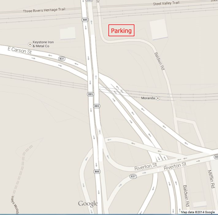
Hays Bald Eagle Walk Leader: Bob Mulvihill
Directions: Glass Run Rd. to Baldwin Rd., left on Baldwin Rd. to parking lot of Keystone Iron and Metal Co. (before railroad tracks). Cross railroad tracks on foot and take the heritage Trail on your left ( a tall stone wall flanks the trail on your right) eagle watching spot is a few hundred yards down the trail. The address for a GPS is 4901 East Carson Street.
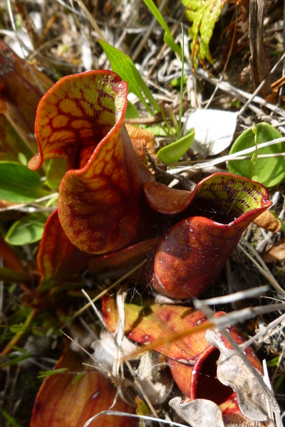
Saturday, June 28, 2014, 10:00 AM Markleysburg Bog, Fayette County
Leader: Loree Speedy, 724-518-6022; loreespeedy@gmail.com
Directions: The intersection of US40 & PA381 can be reached by traveling US40 east from Uniontown, or by traveling PA 381 south from PA Turnpike Exit 91 – Donegal (travel PA 31 east 2 miles).
At the intersection of PA 381 and US 40, travel US40 east 6 miles. Look for an oversized sign on the right reading “Truck Warning-Steep Grade.” Turn right at the foot of this sign onto a blacktop driveway into the Mountain Fellowship Center, marked with a blue sign. Continue past the community building on the left and park along the right side of dirt road.
Prepare for wet feet. Protection at least 4 inches over the ankle is recommended as the bog is not deep.
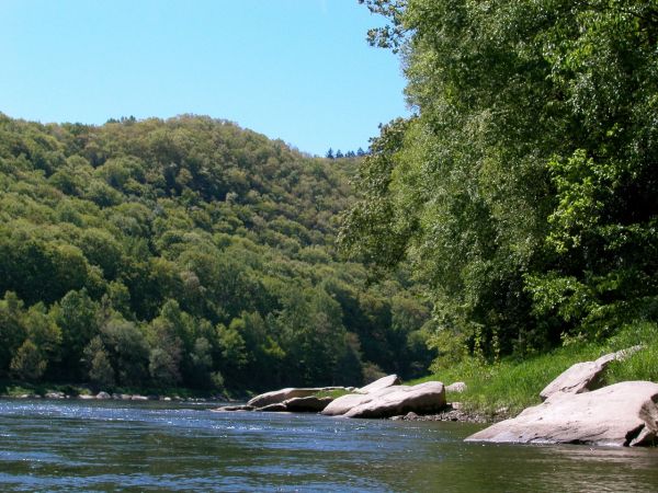
Saturday, May 3, 2014, 10:00 AM
Foxburg, Clarion County & Parker Game Lands – Bear Creek Area, Butler County
Leader: Dianne Machesney
Contact Information: DIANNEM15237@aol.com; cell: (412) 523-0368; home: (412) 366-7869
We will walk a nice paved trail that goes along the Allegheny River for about a mile and then turn back. Plan to have lunch at the Foxburg Inn; good food at decent prices and a glass walled dining room overlooking the river. After lunch, we will travel south about 3 miles to the Bear Creek area in the Parker Game Lands. We will walk along the road looking for wildflowers on the banks.
Directions: From Pittsburgh, travel PA 8 north to Butler. In downtown Butler, turn right onto Cunningham St to pick up PA 68 east. Travel PA 68 east for 1.5 mile to pick up PA 38 N. Continue on PA 38 N for 21 miles to PA 58. Turn right onto PA58 and continue about 7 miles to the Foxburg Bridge over the Allegheny River. Take first right after the bridge into the parking lot. Go to the far end and park. If using GPS, use the address for the Foxburg Inn, 20 Main Street, Foxburg, PA 16036.